Historical Markers
Dorris created this page many, many years ago but I had to recreate the links and I'm not sure I did it correctly. To make things more confusing, there have been many new markers since that time. If we have more information on a marker, there is a link to a paragraph further down the page. If I have time, I'll make a new list of markers but, in the meantime, you can find them at the State Atlas site; use the "County" search tab.Downtown
| 1881 Plaque | State National Bank |
| 1st Episcopal Church | 218 N. Mesa St. |
| A City is Born | S. El Paso St. side of Hotel Paso Del Norte |
| Butterfield Stage | SE corner E. Overland & S. El Paso Sts. |
| Camino Real | San Jacinto Plaza |
| Coming of the Railroad | Pioneer Plaza |
| Death of a Marshall | S. El Paso St. next to Capri Theater |
| El Paso Confederate States | San Jacinto Plaza |
| El Paso's First Newspaper | Pioneer Plaza |
| First Catholic Church | 612 N. Oregon St. |
| First Kindergarten | Pioneer Plaza |
| First Masonic Lodge | 301 E. San Antonio |
| First Railroad Bridge | Pioneer Plaza |
| First School | 408 E. San Antonio |
| Flag Pole | West of US Courthouse |
| Fort Bliss Centennial | San Jacinto Plaza |
| Heroes Monument | West of Public Library |
| John Wesley Hardin | E. San Antonio, Lerners Dress Shop |
| Knights of Columbus | S.E. corner N. Campbell & Myrtle Ave. |
| Mandy & the Mule Car | N. El Paso & W. Missouri Sts |
| Meeting of the Presidents | N. Oregon & Main Sts. |
| Men from Juarez | West of US Courthouse |
| Mills Building | Mills Building |
| Mills Survey | Lobby of Mills Building |
| Pearl Harbor Memorial | West of US Courthouse |
| Ponce De Leon Site | Lobby of the former White House Dept. Store |
| Rotary International | Cleveland Square |
| San Jacinto Plaza Plaques | San Jacinto Plaza |
| Shooting of Four Men | Southeast corner Hotel Paso Del Norte |
| Sun Bowl | 306 N. Mesa St. |
| Temple Mount Sinai | 100 West Yandell St |
| The Calveryman | Calvary Park, west of library |
| Vietnam Memorial | West of US Courthouse |
| Women's Club | Pioneer Plaza |
| WWI Memorial | West of Aztec Calendar |
| WWII and Korean Conflict Memorial | West of US Courthouse |
West El Paso Markers
| 1st Smelter in Texas | ASARCO Main Office |
| American Canal | |
| Blue Star Memorial Tribute to US Armed Forces | Main St. Anthony, TX. |
| Boundary Marker #1 | Monument Park, S. of railroad trestle, west of river |
| Civil Engineering Marker #1 | Monument Park |
| Confederate Memorial | I-10 at Tx.-New Mexico State Line |
| Discover Texas | I-10 at Tx.-New Mexico State Line |
| Doniphan's Volunteers | UTEP Campus - Centennial Museum |
| El Paso Del Rio Del Norte | W. Paisano, 1/2 mile n. of railroad trestle |
| Engine #3420 | Union Station |
| Engine, Old No. 1 | UTEP Campus - Centennial Museum |
| Fort Bliss Officers' Quarters | 1838 W. Paisano |
| James Magoffin | S. of La Hacienda Cafe |
| Pass of the North | W. Paisano, 1/2 mile n. of railroad trestle |
| Simeon Hart | S. of La Hacienda Cafe |
| Smelter Vocational College | ASARCO Plant |
| Southern Tip of Franklin Range | Tom Lea Park |
Central El Paso Markers
| 100th Anniversary | Fort Bliss Replica |
| 12 Bronze Plaques | Scenic Point, Scenic Drive |
| 125th Anniversary | Fort Bliss Replica |
| Bridge of Americas Bronze Marker | Cordova Bridge, East |
| Chris Fox, Jr. Memorial | Scenic Point, Scenic Drive |
| Colonel Bliss | Fort Bliss Replica |
| Council of Garden Clubs, Inc. | Memorial Park |
| El Paso Lodge #130 | 1505 Magruder |
| First Fort Bliss | 2100 Magoffin |
| Fort Bliss C.S.A. | Fort Bliss Replica |
| Fort Bliss Center | Fort Bliss Chapel |
| George Ruhlen | Sheridan Road, across from Pershing Residence [constructed 1st building in Fort Bliss] |
| Hueco Tanks | Hueco Tanks Area [U.S. 63-180, 20 miles east of El Paso] |
| Lion's Club Lion | Cordova Bridge [Bridge of the Americas] border Inspection Station |
| Magoffin Home Dedication | Magoffin Home |
| Magoffin Homestead | Magoffin Home |
| Mount Franklin Elevation | Scenic Point, Scenic Drive |
| Murchison Park | Scenic Point, Scenic Drive |
| Scenic Drive Markers | Scenic Point, Scenic Drive |
| School of Mines | corner of Chafee and Pleasonton, Fort Bliss |
| Southwestern General Hospital | 1221 N. Cotton St. |
| Texas Patriots | Fort Bliss Replica |
| U.S. Military Reservation | Fort Bliss Replica |
| W.W.S. Bliss Memorial | Sheridan Road, across from Pershing Residence |
| World War 1 Memorial | Memorial Park |
Lower Valley El Paso Markers
| Casa Ortiz | Socorro Road |
| Espejo Beltran Expedition 1582-1583 | San Elizario |
| Frank Jones | Alemeda & Valdespino, west of Ysleta |
| Juan De Oñate Expedition 1598 | San Elizario |
| Los Portales | San Elizario Chapel |
| Old County Jail | Old County Jail site |
| Presidio of Nuestra Senora Del Pilar Y Glorioso San Jose | San Elizario Chapel |
| Presidio of San Elizario | San Elizario Chapel |
| Rodriquez-Chamuscado Expedition 1581 | San Elizario |
| Salt War | San Elizario Plaza |
| San Antonio de Senecu | at the intersection of Alameda Ave and Valdespino St |
| San Elizario Cemetery | Socorro at Thompson Rd, San Elizario |
| San Elizario | San Elizario |
| San Lorenzo | Alemeda St. [Fox Plaza Shopping Center] |
| Site of Tienda de Carbajal | Socorro |
| Socorro Mission Marker | Socorro Mission |
| Socorro Mission Markers | Socorro Mission [Texas Centennial and Historical Survey Comm.] |
| The First Thanksgiving | San Elizario Plaza |
| Ysleta Mission Markers | Just north of Ysleta on Alameda; El Paso at Ysleta Mission [State Historical survey; Texas Highway Dept.; Texas Soc. of colonial Dames; & Knights of Columbus] |
El Paso's First Newspaper
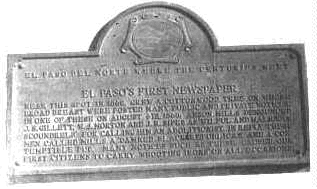 |
This marker commemorates El Paso's first newspaper. The newspaper consisted of a large cottonwood tree on which were posted various public and private notices. It was also used by people passing through town by horseback or wagon train. |
Mills Building
 |
Anson Mills Building, 303 North Oregon Street, El Paso
Early Commercial, 1900-1924 |
Ponce De Leon House
 |
On this spot then near the river opposite the ancient city of Paso Del Norte Juan Maria Ponce De Leon, the first settler on this side, built his house in 1827. |
Meeting of the Presidents
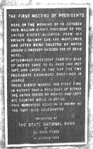 |
Here on the morning of 16 October, 1909, William H. Taft, President of the United States, alighted from his private
railroad car, the Mayflower, and after being greeted by the mayor, Joseph U. Sweeney, entered the St. Regis Hotel.
Afterwards, President Porfirio Diaz of Mexico came to El Paso and met Taft, and later in the day the two presidents exchanged greeting in Juarez. These events marked the first time in history that either the president of the United States or Mexico had left the country while in office. This momentous occasion is known as the Taft - Diaz Celebration. Presented by State National Bank of El Paso Texas |
The Railroads Came to El Paso
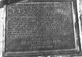 |
From out of the west came the Southern Pacific, 18 May 1881. Down from the north came the Santa Fe, 11 June 1881.
The Texas & Pacific arrived from the east on 25 Dec, 1881. Followed a few months later by the Mexican Central from
the south, 10 May 1882.
So it was with side rods flashing, whistles blowing and bells clanging. The somnolent village on the banks of the Rio Grande came to life. The railroads brought not only goods and services but a breed of willing and hardy pioneers. For railroad families were among the first to buy land, build homes, raise families, supporting their communities with heart and vigor, with all the marching together, El Paso emerged forward as a growing and respected city of destiny at the crossroads of the southwest. |
Butterfield Overland Mail
| The Butterfield Overland Mail was a mail and passenger stagecoach service that linked the Western and Eastern states. John Butterfield, president of the Overland Mail Company, won a federal government contact in 1857 to take and deliver mail twice weekly in both directions between St. Louis, Missouri and San Francisco, California. The service ran from September 1858 until March 1861, when events leading to the Civil War ended its operations. The route had a number of stops, including a large, well-equipped one in Franklin (present El Paso). The route through West Texas, later known as the Upper Road, followed a path from Hueco Tanks into Franklin. Route changes led to the development of the Lower Road, which cut south and followed the Rio Grande through San Elizario and Ysleta. The Lower Road provided a more reliable source of water and better protection from Native American attacks than the Upper Road. Both paths converged at the Concordia settlement, where Concordia Cemetery is now located. The Butterfield Trail continued to Franklin and followed the river north to Cottonwoods (now Anthony, TX), then veered west. The route boosted commerce in El Paso and helped increase the town's population. It also strengthened the city's link to the U.S. Stage service along the Butterfield Overland Mail terminated in 1861, although a Confederate mail service used the trail until 1862. The path later became the base for other routes, including roads and highways. Today, traces of the Upper Road remain visible on Fort Bliss and El Paso International Airport property. The trail's legacy continues to live through the commerce and people which it brought to El Paso, and its bonding of the town to the rest of the United States. (2008) |
John Wesley Hardin
| (May 26, 1853 - August 19, 1895) Born in Bonham, Texas, John Wesley Hardin was named for the founder of Methodism. "Wes" Hardin grew into a family man, cowboy, and outlaw who claimed to have killed more than 30 men. An unusual sort of gunslinger, Hardin considered himself a pillar of society who killed to save his own life. Hardin served 15 years in state prison for murder, was pardoned, then opened a law office in El Paso in May 1895. He was killed 3 months later by John Selman, an El Paso city constable. (1998) |
The Old Mule Car
 |
Southwestern General Hospital
 |
In the late 1800s medical treatment of Tuberculosis called for isolation of the patient and complete rest. After the
turn of the century research showed that bacteria responsible for the transmission of the communicable disease could be
destroyed by sunlight. The dry, sunny climate proved to be ideal for the establishment of sanatoriums and treatment
centers specializing in "sun cures."
In 1907, a tubercular patient, former New Orleans postmaster David Baldwin, opened the Albert Balwin Health Resort in the Highland Park Addition. Dr Charles M. Hendricks served as medical director. In 1910 Balwind leased his interests in the clinic to Dr. R. B. Holman, Sr. joined later by Dr John C. Crimen. He developed the resort into the Holdman Sanatorium. A new facility was built here in 1925. Designed by William Wuehrman. It was called "The Place of the Thousand Windows" because of its open styling which allowed maximum sunlight exposure. With the economic problems of the 1930s depression and advancement of treatments of Tuberculosis the need for sanatoriums declined. In 1937, the Holman sanatorium became a general health care facility and was renamed Southwestern General Hospital. |
First Fort Bliss
 |
El Paso Del Rio Del Norte
 |
On May 4, 1598, Don Juan De Onate, Adelantadd and Captain-General, Governor of New Mexico, first named El Paso Del Rio Del Norte through the old pass, the lowest snow-free feasible route from the Atlantic to the Pacific through the rocky Mountains, extend today the great trunk lines of telegraph and railroad. The City of El Paso marks the place and perpetuates the name. 1936 |
El Paso Del Rio Del Norte
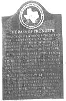 |
Historically a major trade and travel artery of North America because it is the northernmost Rocky Mountain pass
that stays snow-free throughout the year.
Indians used pass before the Spaniard Cabeza De Vaca, though to be the first white man in the area crossed it about 1536. Juan De Onate brought the first cattle into the US through the pass in 1598. Route was heavily traveled during the California Gold Rush 1849 and in later years important stage lines and railroads crossed Rockies here. Today the Pass lies on one of the three major routes across the continent. |
Boundary Marker #1
 |
Boundry of the United States of America
International Boundry and Water commission between United States and Mexico |
Boundary Marker #2
| Civil Engineering Marker #1
International boundry and Water Commission The first international monument of the 276 installed to the west along the international land boundry which marks the international boundry between the United States and Mexico.This monument was placed on Janurary 31, 1855 in accordance with the 1853 treaty and was registered by the international water and Commission between the United States and Mexico on June 2, 1980 in commemoration of the first centennial of the establishment of this international Commission. United States Commissioner Dr. Nareadra A. Gunaji. |
Old Fort Bliss

 |
Fort Bliss Officers' Quarters
Old Fort Bliss, on site formerly in Mexico. Owned after 1849 by Simeon Hart, founder of Hart's Mill and early village of El Paso. Officers quarters, built about 1879 on 3' foundations of hewn stone. 24" walls are double-laid adobe brick. 1965 On this site was established in 1880, in 1896 was moved to its present location. |
Major Simeon Hart
 |
1816-1874
Born New York moved to El Paso 1861, founded Hart's Mill that ground out 100 barrels flour a day and sold to buyers from Arizona to San Antonia.When the Civil War came he was the main source for securing military supplies for the Arizona-New Mexico in 1962. Hart joined the C.S.A. army and was made chief purchasing agent for the War Department west of the Mississippi. His extensive contacts in Mexico and Europe and his knowledge of markets made him able to render great service to the Confedercy which could only exist by trading valuble cotton for war goods through foriegn countries, through his arrangements for supplies. A Union plot to invade Texas across the Rio Grande was thwarted early 1863. Buried in Evergreen Cemetery. Erected by State of Texas 1964 |
Captian James W. Magoffin
 |
Hometown of Texas Confederates
Captian James W. Magoffin, 1799 - 1866 Born in Kentucky, trader, in Mexican War, 1846-47, established trading post at Magoffinville about 1850. Named state agent with Simeon Hart to receive U. S. property surrendered at Ft. Bliss, married 1861 prior to Civil War. This and other military stores obtained through his own standing contacts in Mexico supplied the Confederate Forces in the Arizona-New Mexico campaign 1861-62. made stateGrid. Gen. 1861..left here with Confederate evacuation 1862 as Capt. C.S.A. Business ability utilized to obtain military supplies in Texas, Mexico - State Senator 1863-65 Buried in San Antonio. |
Old Engine No. 1
 |
Old Engine No. 1 |
Doniphan's Volunteers
 |
Doniphan's Volunteers
The First Regiment Missouri Mounted Volunteers under the command of Colonel A. W. doniphan marches to Mexcio to the assistance of General Zachary Taylor camped on this site from December 27, 1846 to February 7, 1847 Rededicated May 1964 by Rebecca Stoddart Chapter Daughters of the American Revolution. |
Southern Tip of Franklin Range
 |
Southern Tip of Franklin Range
This obelisk marks the southern tip of the Franklin Range of the Rocky Mountains, sponsored by the Women's Department of the Chamber of Commerce and the City of El Paso Department of Parks. Plaque presented by the State National Banks of El Paso, Texas March 22, 1974. |
San Lorenzo
 |
Established by Don Antonio De Otermin and Father Fray Francisco Ayeta. O.F.M. in 1682 - maintained by Franciscan missionaries for the civilizing and christianizing of the Zuma Indians. 1936 |
Captain Frank Jones
 |
Born in Austin, Texas, 1856
Killed by bandits, June 30, 1893 near San Elizario while commanding Company D Texas Rangers. |
San Antonio de Senecu
 |
aka Senecu del Sur
Approximate site of the mission and pueblo of San Antonio De Senecu. Established by Don Antonio De Otermin and Father Fray Francisco Ayeta. O.F.M. in 1682 - maintained by Franciscan missionaries for the civilizing and christianizing of Piro and Tompiro Indians. 1936. |
Oldest Mission in Texas
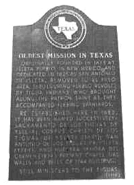 |
Originally founded in 1613 at Ysleta Pueblo, in New Mexico, and dedicated in 1621 as San Antonio de Ysleta. Removed
to El Paso area, 1680 (during Pueblo Revolt), by Tigua Indians who brought along the patron saint as they accompanied
fleeing Spaniards. Re-established here in 1682, it has been named successively: Sacramento de Los Tiguas de Ysleta;
Corpus Christi de Los Tiguas de Ysleta (1691); San Antonio de Los Tiguas de Ysleta (1744); and Nuestra Senora Del Carmen
(1874). Present chapel has walls and bells of 1744 building. Still ministers to the Tiguas. (1970)

 |
San Elizario
 |
San Elizario was established in 1789 on the former site of Hacienda de los Tiburcios as a Spanish Colonial Fort
known as Presidio of San Ecleario. The Presidio was moved from its former location [appx. 37 mls] in response to
requests from settlers for military protection from Indian raids. It operated as a Spanish Fort until 1814 when troops
withdrew during the Mexican War for Independence. [1810-1831]
During its years as a part of Mexico, The Presidio of San Ecleario [now San Elizario] was occupied periodically by Mexican troops. A reduced military presence resulted in the Fort's decline. American controll of the area began in 1848 with the treaty of Guadalupe Hidalgo, which established the Rio Grande as the border between the United States and Mexico. When the County of El Paso was organized in 1850, the town of San Elizario was chosen as the first county seat and served as such until 1873. In 1877 it was the scene of the crisis known as the Salt War, in which local business men attempted to control the salt market that had operated since colonial times. Although San Elizario was bypassed by the railroad and has become a rural farming community, it remains an important element in the region's rich heritage. |
Juan De Oñate Expedition 1598
 |
Spanish interest in the territory known as New Mexico increased during the 1580s and 1590s. Although reports of
mining and missionary possibilities were significant, King Phillip was also concerned about new world explorations of
rival England. As a result, Don Juan De Onate was commissioned to claim and colonize the New Mexico region in the name
of the King.
After many delays, Onate and his party of 400 men and members of their families left Santa Barbara, Mexico in January 1598. Instead of following the earlier routes, they crossed the Chihuahuadesert to reach the El Paso area. IN a ceremony at this site on April 30, 1598, Onate issued a proclamation known as La Toma. Taking possession of the region for Spain included were all land drained by the Rio Del Norte, The Rio Grande. Proceeding north, Onate established headquarters near present Sant Fe and founded the province of New Mexico. As Governor, he directed exploration of the area until he resigned in 1607. Onate's expedition and La Toma brought Spanish rule to the American Southwest and proceded colonization efforts of other european nations on the north American continent. 1981 |
Rodriquez-Chamuscado Expedition 1581
 |
Inspired by Indian stories of settlements in present New Mexico and authorized by the Spanish viceroy, Fray Agustin
Rodriquez, a Franciscan priest, led a missionary expedition to the area. Accompanied by Fray Juan De Santa Maria, Fray
Francisco Lopez, nine soldiers, and nineteen Indian servants. He left Santa Barbara, Mexico, on June 5, 1581. The
military escort was led by Francisco Sanchez, who became his red bear, was known as El Chamuscado, "the Singed".
Following the Rio Grande the expedition reached El Paso. Proceeding through the pass they spent the remainder of 1581 exploring the vast region from present western New Mexico to the Texas Panhandle. After Indians killed Fray Santa Maria in September 1581, plans were made to return for a report to the Spanish authorities. Despite the hostile enviroment, the two remaining missionaries chose to stay. Chamuscado led the others back through the pass of the north, but died before reaching Santa Barbara. Believed to have been the first Spanish expedition to use the pass of the Norte, The Rodriquez-Chamuscado Expedition marked the beginning of the Spanish influence in the ares. Their exploration opened the region, now the American Southwest, to later colonization. |
Espejo Beltran Expedition 1582-1583
Salt War
 |
The Salt War rose from political conflicts in the El Paso County and from the controversiers over control of the salt lakes east of El Paso that for centuries had been a free source of salt for local residents. In 1877 Charles Howard, a former county jusge who claimed ownership of the lakes, shot political adversary Luis Cardis over the issue of the salt beds. While under the protection of state troops in San Elizario, Howard and sever troopers where killed by a riotous mob. Federal and state investigations of the salt war led to the reesatablishment of Fort Bliss in 1878. |
The Camino Real
 |
W. Paisano Dr., in marker plaza 0.2 mi. S of Ruhlen Ct. on restricted access/private property. One of five markers
by this title in El Paso County.
For more than 200 years the Camino Real, or Royal Road, was the major route for transporting commercial goods from Mexico City and Chihuahua to Santa Fe and Taos. First traveled by Juan de Onate during his 1598 expedition to New Mexico, the Camino Real followed the San Elizario, Socorro, and Ysleta Road, crossed the Rio Grande west of present downtown El Paso, and continued north into New Mexico. When the Rio Grande was established as the U.S. - Mexico boundary in 1848, this section of the old Camino Real became part of the United States. (1983) |
Old County Jail
 |
This structure was built about 1850 of adobe bricks [sun-dried mud and reeds] and cottonwood logs around steel cell blocks. It served as county jail from 1850 - 66 and 1868 - 1873, when san Elizario was the first and third county seat. It housed both jail ("carcel" in Spanish)and courtroom ("juzgado"). According to ledgend, william Bonney, famed outlaw billy the Kid, freeded the only man ever to escape from this jail, his cohort Melquiades Seguro. Recorded Texas Historical Landmark 1970. |
Socorro Mission Historical Registery
 |
Entered in the National Register of Historical Places 1972 |
Socorro Mission La Purisima
 |
During the Pueblo Revolt of 1680, Gov. Antonio De Otermin and Father Francisco de Ayeta led Piro and Spanish refugees out of New Mexico and into this region, establishing a settlement they called Socorro after the home they had left. The town's first adobe Church was built in 1691 and was called Nuestra Senora de la Limpia concepcion de las Piros del Socorro [Our Lady of the Immaculate Conception of the Piros of Socorro.] Construction of the present structure began following a destructive 1829 flood and was completed in 1840. The flood changed the course of the Rio Grande from North of socorro to south of the townsite. When the river was declared the U.S./Mexico boundry, Socorro became part of the United States. Under the adminstration of the Franciscan monks for 172 years, the church was later governed by dicesan priestsas well as Italiand and Mexican Jesuits. Its history spans the time of the regions occupancy by spain, Mexico, and the United States, although Socorro Mission La Purisima, as it is know today, has been overshadowed by urban growth in nearby El Paso. It remains one of the oldest continuously occupied settlements in the southwest. |
Casa Ortiz
 |
Legend says this house was built before 1800. In 1840s, its owner was Jose Ortiz, whose cart train freighted salt from foot of Guadalupe mountains to Durango; knives, sarapes, clothing to Santa Fe and Llano Estancado. There he traded with Comanches and other wild indians for dried buffalo hides and meat. He was a "Comanchero, Salinero, Cibolero"> Francisca Lujan, the widow of Epifanio Ortiz (1842?-1932), was last of family to live here, in 1940s. a fine example of New Spain's frontier architecture: thick adobe walls; cottonwood and willow vigas and latias with dirt roof. Recorded Texas Historic Landmark - 1973. |
Site of Tienda de Carbajal
 |
Site (partially reclaimed) of a 19th century walled hacienda appearing on 1852 map near San Elizario Road crossing of Acequia Madre. By 1873 part of the building was razed, but surviving parts were occupied by store of Juan Carbajal and some municipal offices. 1972 |
Los Portales
 |
Local farmer, rancher, and landowner Gregorio Nacenseno Garcia constructed this building as his family's residence about 1855. Built in the territorial style, it features milled wood detailing. Because of its distinctive inset gallery (portal), it became known as Los Portales. In the 1870s, the structure was converted to use as a schoolhouse. The first teacher was Octaviano Larrazola, who later became governor of New Mexico and a U.S. Senator. Recorded Texas Historic Landmark - 1962 |
San Elizario Cemetery
 |
San Elizario Catholic Church during the early days served as the mother Church for this and surrounding communities.
This land served as a cemetery from the early 1770's to 1896. Early settlers, Indians, U.S. military personel, clergy
and members of religious orders were buried here.
The last known person buried here was Juanita Escajeda Carreon in 1896. The youth of San Elizario dedicate this land as a memorial to those people buried in these grounds. 1989 |
The First Thanksgiving
 |
Late in November 1597, a colonizing expedition headed by Juan De Onate left Santa Barbara in northern Chihuahua
headed for what is now New Mexico, four hundred men led the way, some of whom had wives and children, there were several
priests, 63 wagons and carts, 1000 head of stock, they were planning to stay.
They reached the Rio Concho and after a needed rest, Started out again on February 7 marching on northward over the barren desert of Chihuahua for several weeks. The last four days without water, the expedidtion finally reached El Paso Del Norte [near the present day San Elizario] April 26 1598. The Poet-chronicler of the march, Gasper Perez De Villagra wrote that the river was a most welcome sight."Horses approached the rolling stream and plunged headlong into it, two drank so much that they burst their sides and died," some of the humans went almost as wild. The arrival was a "happy and joyous occasion," and all were in a thankful mood. Grateful for the completion of a perilous part of their journey, abundance of water, plenty of wild game along the river, the expedition set about preparation for a great celebration, The First Thanksgiving in what is now the United States of America which took place on April 30, 1598. The great colonizer, as Onate has been called, thus brought the Spanish culture [and ultimately that of Mexico] to what would become the Great Southwest shaping its growth anddevelopment of the area for generations. these historic events preceded the English colonies on the Atlantic Seaboard, the french colonization of Canada, and the Dutch settlement in the Hudson River area by several years. |


